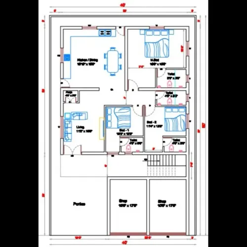
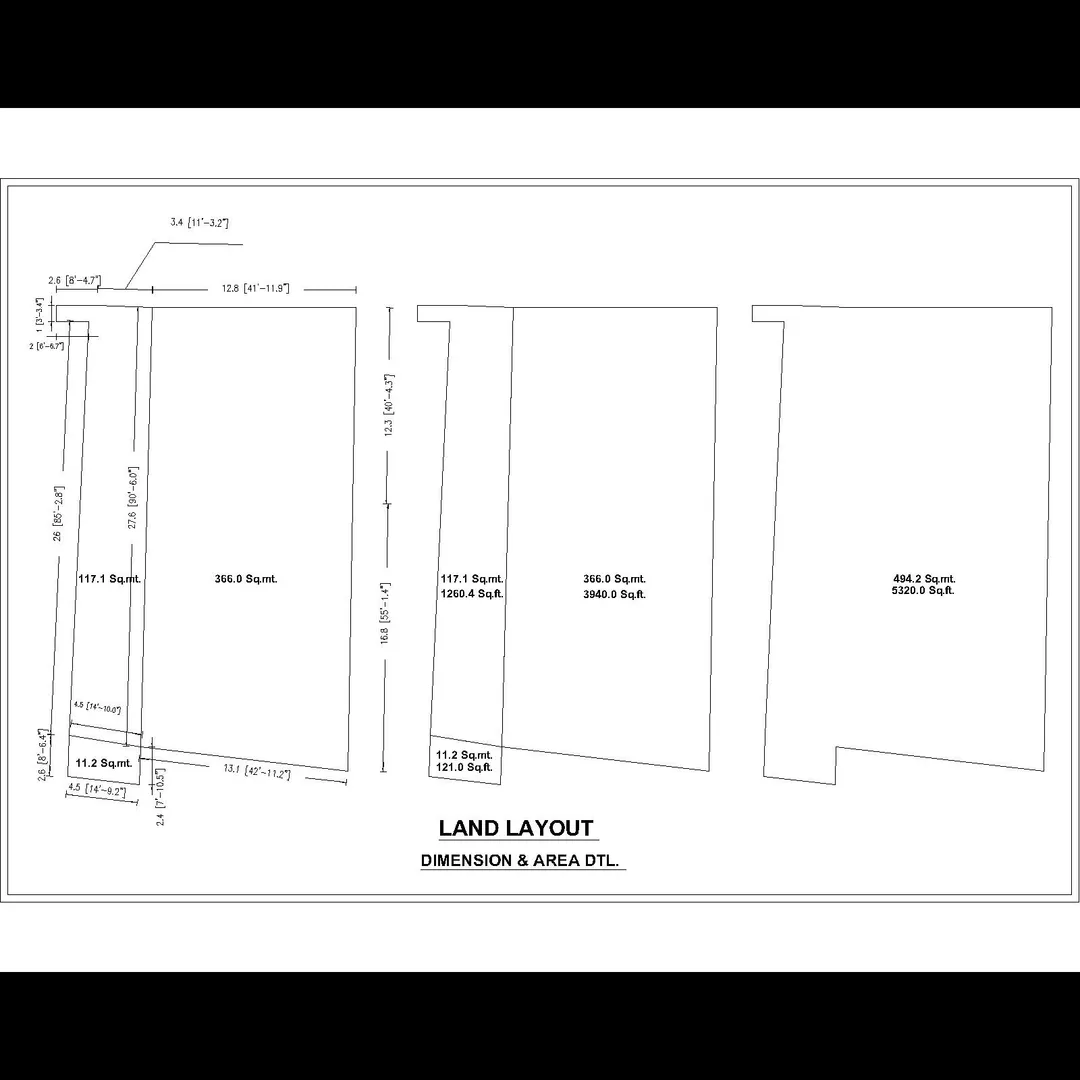
Land layout drawing :
Land Layout Drawing Details (Plot Layout / Site Layout Plan)
A Land Layout Drawing (also called a site layout, plot layout, or land use plan) is a scaled drawing that shows how a piece of land is subdivided, developed, or used for construction or planning purposes.
It is essential for town planning, real estate development, residential plotting, industrial layouts, and municipal approvals.
🧭 What Is a Land Layout Drawing?
A Land Layout Drawing shows the division of land into plots, roads, amenities, and open spaces, usually as part of a larger development plan. It is often prepared by architects, urban planners, or civil engineers.
📐 Key Components of a Land Layout Drawing
ElementDescriptionSite BoundaryClearly marked perimeter of the land parcel (with dimensions and bearings)Plot DivisionSubdivision of land into individual plots/lots with plot numbers and areasRoads & StreetsInternal roads, their widths, turning radii, and hierarchy (main, secondary, etc.)Setbacks & MarginsBuilding lines and no-construction zones marked around plotsNorth ArrowOrientation of the site (mandatory in all layout drawings)ScaleCommon scales: 1:500, 1:1000, depending on site sizePlot AreasEach plot is labeled with plot number and area (e.g., 'PLOT 3 – 240 m²')Access RoadsConnection to public/main road, entry/exit gatesAmenity SpacesParks, play areas, community hall, STP, transformers, etc.Drainage/UtilitiesSometimes shown schematically — sewer, water line, power cable trenchesTopographical FeaturesIf applicable: contours, trees, water bodies, high/low pointsApproval BlocksTable showing area statement and authority stamps (for submission)
📏 Standard Dimensions in Land Layouts (Indicative)
ElementTypical SizeResidential Plots30′x40′ (1200 sqft), 40′x60′ (2400 sqft), etc.Road Width9m (main road), 6m (internal roads), 12m+ (for commercial)Footpaths1.5 m to 2 m on either side of roadsOpen Space (OSR)10% of site area (as per local norms)Park AreaVaries; usually min. 5–10% of total areaPlot FrontageMin. 6 m (for residential), wider for corner/commercial plotsBuilding SetbacksAs per local bye-laws (e.g., 1.5 m side, 3 m front)
📑 Area Statement (Usually in Table Format)
DescriptionArea (m²)% of TotalTotal Site Area10,000 m²100%Plot Area6,500 m²65%Roads2,000 m²20%Parks / OSR1,000 m²10%Public Utilities500 m²5%
🏛️ Regulatory Requirements (India)
- CMDA, DTCP, BDA, HMDA, etc. depending on city/state
- NBC 2016 – National Building Code guidelines
- UDPFI Guidelines – Urban Development planning norms
- Fire Department – Access roads for fire tender
- MoHUA Guidelines – For Smart Cities and greenfield developments
Submission format must include the digital CAD file + signed hard copy, with:
- Ownership documents
- Survey numbers
- Proposed layout
- Roads and OSR clearly marked
- Land use zoning compliance
🖊️ Notes Typically Found on Land Layout Drawings
- “All dimensions in meters unless noted.”
- “Layout prepared as per DTCP norms.”
- “Road widths as per municipal bye-laws.”
- “All electrical, sewer, and water lines to be laid along road centerlines.”
- “Rainwater harvesting pits to be provided per plot.”
🏙️ Land Layout Use Cases
Project TypeKey FocusResidential PlottingMaximize saleable area, street hierarchy, OSR, parksIndustrial LayoutLarger plot sizes, truck access, utility corridorsInstitutional CampusZoning for academic, hostel, sports, adminTownship / Smart CityMixed-use zoning, mobility plan, green spaces
🖼️ Want a Sample Land Layout Drawing?
If you provide:
- Site area (in m² or acres)
- Purpose (residential, industrial, institutional)
- Required plot size or number of plots
- Road access (width, number)
- Any special features (parks, clubhouse, commercial corner)
I can help you prepare a concept land layout plan in schematic or CAD-ready format.
Email : www.bechennai.com, Mobile no : 888 333 33 22.
Keywords