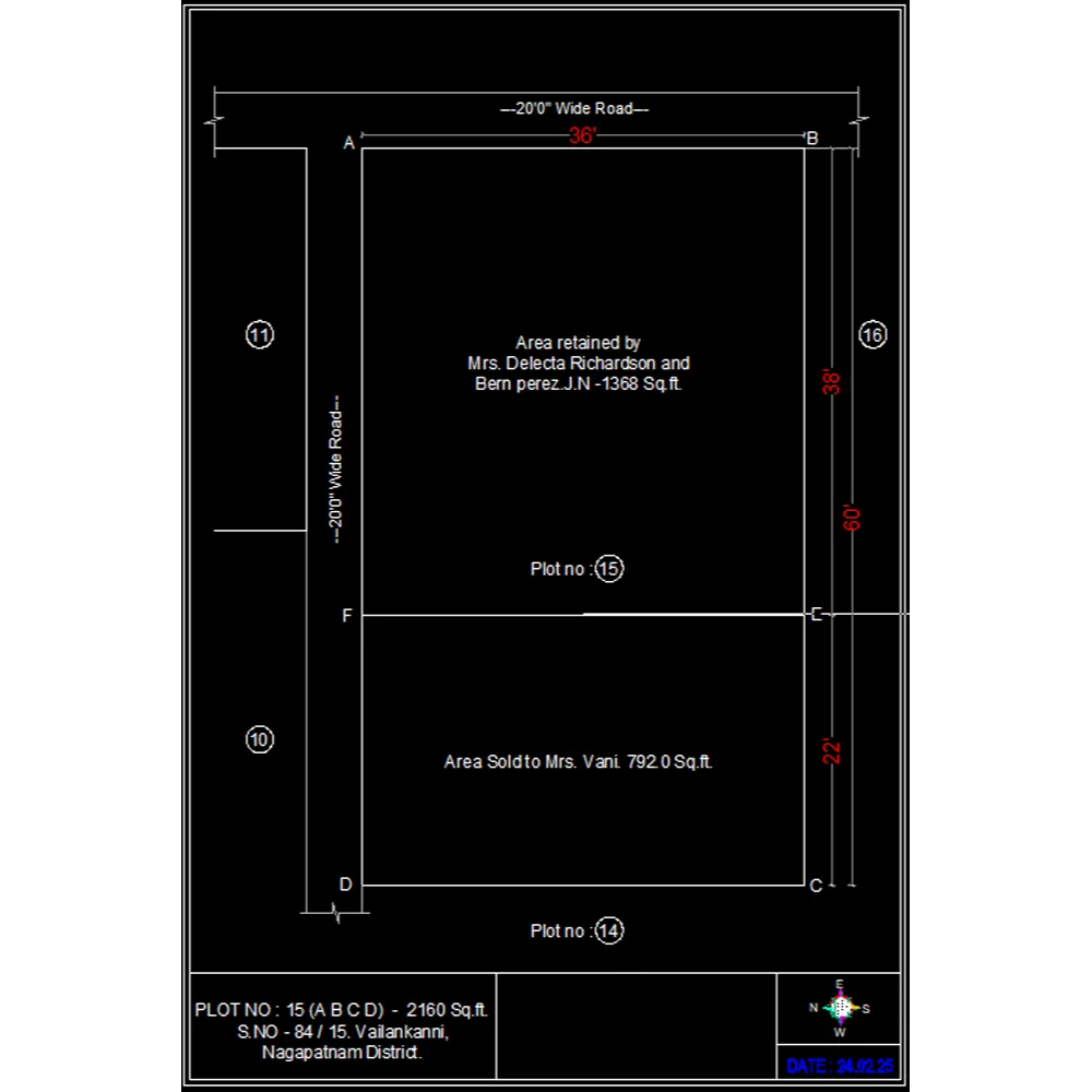
Subdivision drawing :
🔹 Key Details Included in a Subdivision Drawing:
🗂️ 1. Site Information
- Title block with:
- Project name
- Location (address or coordinates)
- Plot number and survey number
- Name of owner/developer
- Date, scale, and drawing number
- North direction indicator
- Scale bar
📐 2. Layout of Plots
- Numbered plots with individual dimensions (length × width)
- Total number of plots created
- Area of each plot (in sq.m or sq.ft)
- Boundaries of the entire subdivision and individual lots
- Reserved or common areas (e.g., parks, community space)
🚧 3. Infrastructure
- Road network (internal streets, widths, road types)
- Sidewalks, footpaths, and setbacks
- Drainage layout (stormwater drains)
- Water supply lines and sewer lines
- Electricity and utility lines (optional at preliminary stage)
🌳 4. Open Spaces & Amenities
- Parks and recreation areas
- Green belts, landscape zones
- Community facilities (e.g., clubhouses, playgrounds)
5. Compliance and Approvals
- Zoning information (residential, commercial, etc.)
- Adherence to local planning authority rules
- Legend and notes explaining symbols used
- Approval stamps from local bodies (e.g., municipal office, town planner)
🔎 Uses of a Subdivision Drawing:
- Planning Approval: Required by local municipal/town planning authorities before development can begin.
- Real Estate Sales: Helps buyers understand the size and shape of plots.
- Construction Planning: Guides engineers and contractors during infrastructure development.
- Legal Documentation: Forms part of the official record of land division and transfer.
- Utility Coordination: Essential for laying utilities and services.
Email : www.bechennai.com, Mobile no : 888 333 33 22.
Keywords